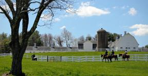
Drone Footage of Sandy Hook Memorial Site & Surroundings
As you watch this video, please keep in mind that not all areas shown are of the memorial site, but is inclusive of some surrounding fields. Please review the Guidelines for Selecting a Design to understand specifically what portion of this land is for the memorial. Specific time stamps are listed below to guide you through the video. Thank you to R&O Drone Services LLC for contributing their time and talents to this project.
0:00 - 0:25 - Entrance of Memorial
0:26 - 0:32 - Upper Field (Please review the GSD to understand upper field portion used for the memorial).
0:33 - 0:50 - Aerial views of upper field and lower field ((Please review the GSD to understand upper field portion used for the memorial).
0:51 - 0:56 - Aerial views of lower field and ponds
0:57 - 1:01 - Upper Field
1:02 - 1:17 - Aerial views of memorial (Please review GSD to understand what specific parcels are relevant for the memorial space as not all space shown in aerial photos is of the memorial site. The GSD will better define this.)
1:18 - 1:29 - Exit of the memorial


